
Linnea Andersson
22 Vejbystrand - Ängelholm/Utvälinge
- Length
- 13 km
- Degree of difficulty
- Blue
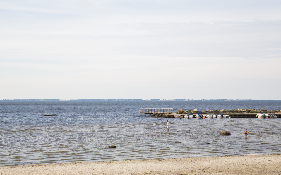
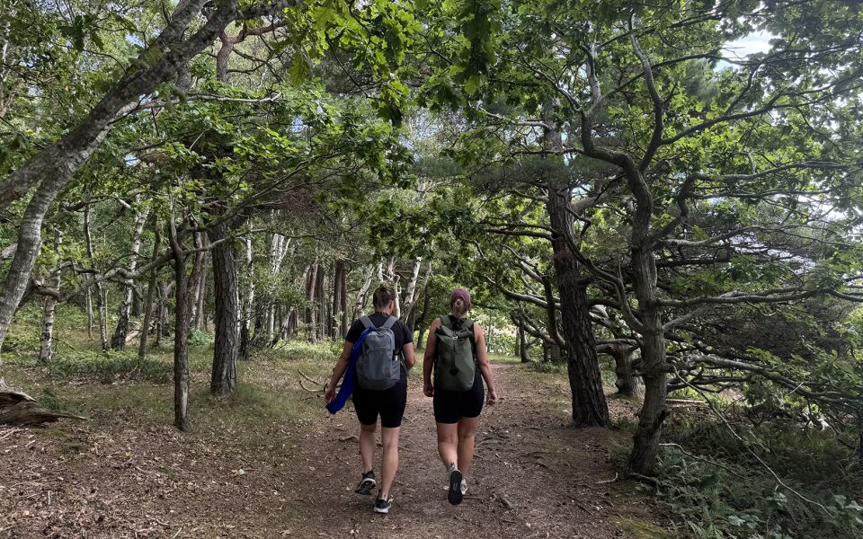
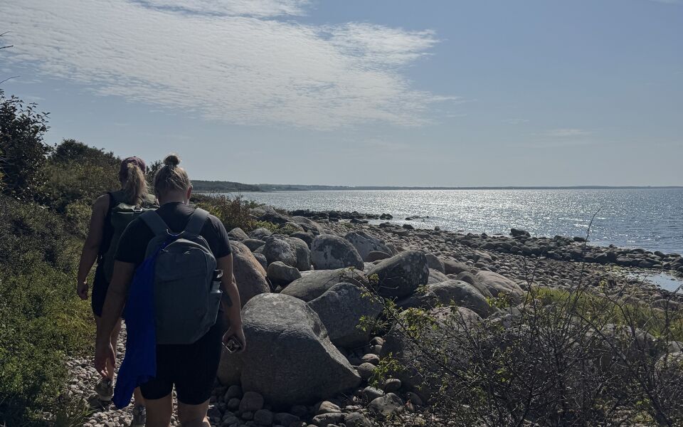
Hike along seaside paths by Skälderviken Bay and enjoy the company of the sea. You'll pass bathing resorts, marinas, and impressive sand dunes. Stop by art studios, museums, or follow the Rönne River upstream. Along the way, you'll find scenic rest areas with views stretching all the way to Kullaberg.
Vejbystrand is the fishing village turned spa resort that once housed Sweden’s first coastal sanatorium for tuberculosis patients. Inland from the coast, a string of Bronze Age burial mounds lines the hills, and along “Utsiktsvägen” you’ll find the Bökehögarna mounds worth visiting.
At the harbor in Vejbystrand, rocky reefs are teeming with birdlife. Between Vejbystrand and Magnarp, the trail crosses heathland with sea thrift, wild roses, and juniper shrubs. The walk through Skepparkroken offers cultural heritage with winding roads past old captain’s farms and street houses. The area once belonged to the Ängeltofta estate, from where grain and iron plows were shipped out in large quantities.
In Skälderviken, there’s a marina holding hundreds of boats, as well as a memorial honoring the men who built the harbor. Those with boots earned 60 öre a day, while those without got 50. The cannon you see was once part of the pier — the rear end was used to moor boats. East of the Rönne River lies the ruins of Luntertun Church, once a medieval town and market hub for salmon and herring. Today, Luntertun is part of the town of Ängelholm.
Continue your walk across the Rönne River, known for its salmon and sea trout, and explore the sand dunes — the "klitter". Closer to the shore, windswept pine trees and brush dominate the heath. Further inland, pine forests offer coralroot orchids and an abundance of mushrooms. Keep an eye out for the tawny pipit, sea-wall bee, and bee beetle.
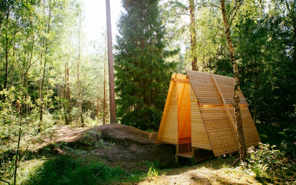
Finally, you’ll enter the Kronoskogen nature area — home to salty sea baths, white sandy beaches, and tall pine trees. This idyllic area features numerous marked trails and a mountain biking zone — all just a stone’s throw from trains, buses, and the comforts of downtown Ängelholm. Don't miss the unique wind shelter 4rest.
This stage ends in Ängelholm, but you can also choose to continue toward Utvälinge via stage 23, without entering the city center.
13 km
Degree of difficulty
About Difficulty Grading
The grading is tailored for Swedish lowland trails that adhere to the quality criteria established by the national framework for hiking trails.
Even and firm ground: The terrain is generally flat. The hike requires no need to use your hands for support. No obstacles. Bridges are always present when crossing waterways.
Uneven and/or soft ground: Some changes in elevation. Certain sections may require hand support to maintain balance. There may be obstacles such as low stiles and short stairs. Minor obstacles like stones and roots. Boardwalks are present.
Loose or slippery ground combined with steep sections: Technical parts require hand support. There may be obstacles such as high stiles and longer stairs. Frequent sections with stones and/or roots. Boardwalks with deeper surrounding water.
Note: One or more of these features may be present along the trail section.
Blue
4-5 timmar
- Kustnära
- Stadsnära
- 7-15 km
- Lätt
- Barnfamiljer
- Kollektivtrafik
- Skåneleden
Highlights along the section
Are you looking for a place to stay or a cozy cafe during your hike? Here are some of the sights and places to visit along the section.
Hiking suggestions
Do you find it difficult to know where to start your hike? Here is some inspiration and a selection of recommended hikes - short and long, with or without accommodation or based on different themes.
Show allNews
Here you will find information about what's new on the trail as well as current redirections and disturbances.
Continue on the trail
Share your moments
Share your adventures on the trail by tagging your photos with #skåneleden or #skaneleden.