
Where? Brösarp-Vantalängan-Brösarp (via Backaleden). Length: 6 km. Difficulty: Moderate
This hike follows Skåneleden Trail’s sub-trail SL4, Österlenleden Trail, and the local Backaleden Trail, in southeast Skåne.
If you come via public transportation, you can take SkåneExpressen’s regional bus number 3 or 4 (yellow buses) to the Brösarp Torparebron bus stop. If you arrive from the south, you cross (carefully!) Route 19 and continue in a northwest direction toward the large parking area. Here the Skåneleden Trail splits into two different directions. Go to the very back of the parking area and follow the orange markers leading west.
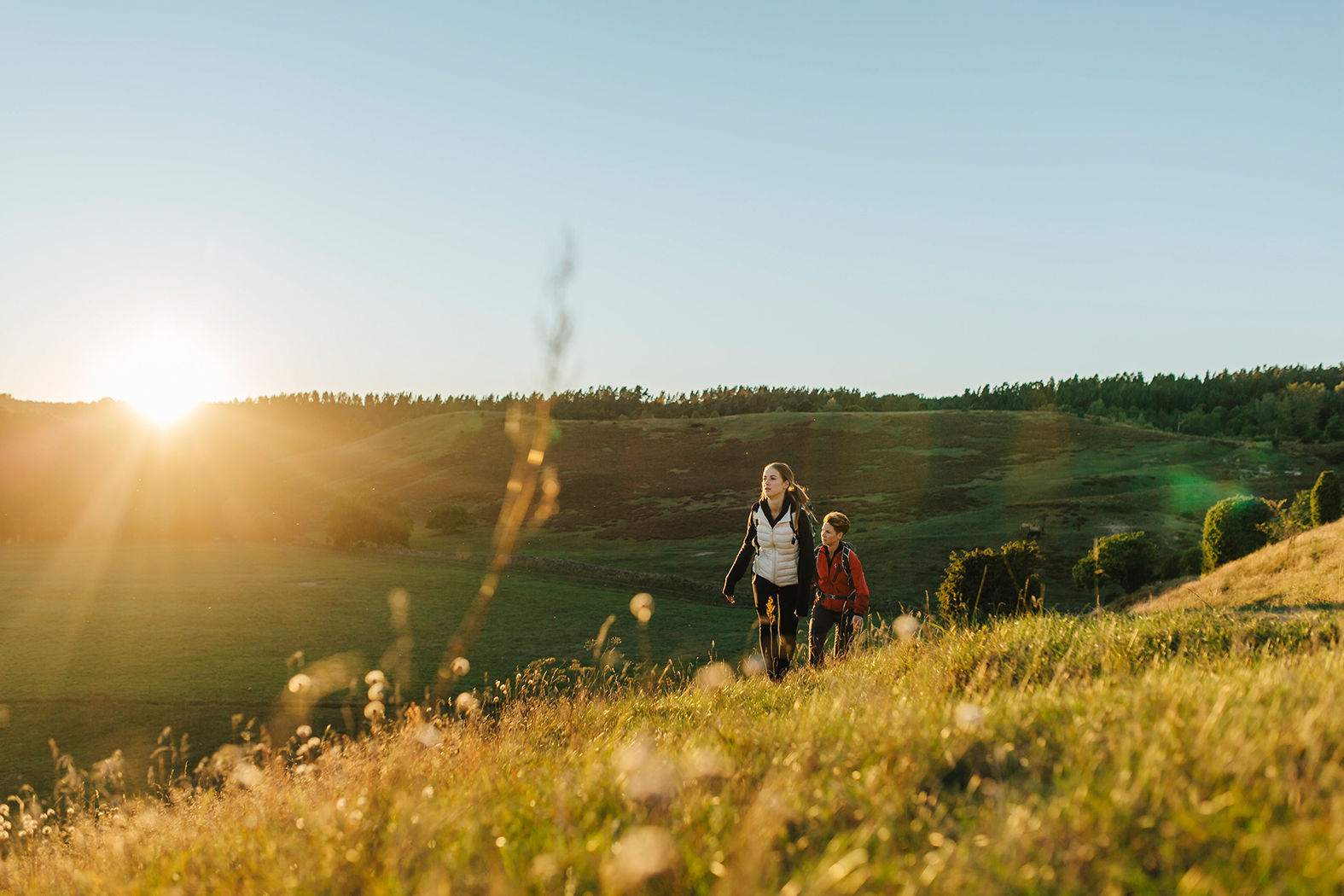
Once you’re on the trail, you pass a grove of trees, cross over the road to Norra Björstorp, and then climb over a stile. From here you can look out over the village of Brösarp to the south and to the north, you see your destination, the north section Brösarps Backar.
Walking through and over this hilly, sandy heathland is heaven, even if the hills do present a steep climb now and then. The hills are criss-crossed with the trails created by cattle as they wander through their grazing lands. In the summer, the air is full of the scent from such flowers as Sand Pink, a very rare perennial which is protected under the EU Habitat Directive, Meadow Saxifrage and wild thyme. Brösarps Backar are a part of the Verkeån River Valley Nature Reserve, and at times you will come quite near the waters of the Verkeån River, crossing small creeks every now and then.
In 1977 one of Sweden’s most beloved children’s stories - The Brothers Lionheart written by internationally acclaimed children’s author Astrid Lindgren - was partly filmed in these rolling hills. In the film, Brösarps Backar are portrayed as the mythical, heavenly kingdom of Nangijala, and the evil dragon Katla sets fire to the slopes.
Once you leave the northern hills of Brösarps Backar, your footsteps carry you along a gravel trail. After crossing a road, you approach the Vantalängan Campsite. You pass a parking area before coming to the actual Campsite and shelter – which was originally a barn built in the 1800s.
There’s plenty of space for a tent in the generous area by the barn, and there are several grills. Water is usually available from a pump, but you must boil it before drinking. Chill for a while in this peaceful place. Rest, maybe have lunch and enjoy the surroundings.
When you’re ready to leave Vantalängan Campsite, you enter the forest just after the water pump. Here you leave the Skåneleden Trail swinging south, trading the orange markers for the yellow markers of the local Backaleden Trail. Cross the bridge over the rushing waters of Verkeån River. And here you must be observant! Head east toward Brösarp, and not southwest toward Hallamölla. Wander through an open deciduous forest and past a field until the trail starts to climb.
Follow the dirt road for a short bit past ancient, moss-covered leafy trees, and a summer cottage area, until you arrive at Linget, a popular party place in the 1950s, and where a shooting range and football field were maintained until 1975. Linget was very simple at first. Those who felt like dancing, danced on the grass, and the bands played under an open, makeshift shelter next to a big oak tree.
Once you cross Brunnsviksbäcken Creek, you abandon the dirt road and point your feet south as they carry you into the forest. You wander past towering beech trees, the tops of their roots exposed and covered in moss. The rolling landscape is interesting and peaceful, all at the same time. The trail follows a babbling brook as it leads you to another rest area and a small boulder before bringing you to the Tockabjär Spring, one of several springs in the Tockabjär Ravine, where cold groundwatersurfaces. Take the time to explore this place. The spring itself is located just a bit up in the terrain, just after you cross a little footbridge.
After the spring, the trail follows Brunnsviksbäcken Creek closely for a short while, and it’s wise to be a little extra careful along this stretch. It’s slippery when wet. After a while, the trail transitions to a dirt road, and you pass a cut-over area for sustainable harvesting of trees. Soon you find yourself back on Route 19. Cross the road, and keep well in to the side as traffic can be heavy at times. Turn off onto the Brunnsviksvägen road. Soon you come to the little community of Brösarp which boasts a grocery store and a few places where you can order something to eat and drink - just in case you’ve worked up an appetite. At the Brösarp bus terminal, you can catch a bus home.